RIU-Net Row Detection for LIDAR-base navigation

My Contribution Highlights
- Trained an RIUNet using Python and Pytorch, enabling LIDAR-based in-row navigation when GPS are not reliable enough
- Implemented data augmentation and weight-map to improve performance
- Implemented conversion between range-images and pointclouds, as well as their visualization functions
More About the Project
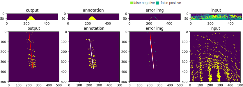
Inspired by my capstone project at Carnegie Mellon University, I conducted an independent study at Field Robotic Center under George Kantor’s supervision. My role was to investigate pure LIDAR-based, in-row navigation for algricultural robots. I converted LIDAR data collected from field and manually labeled them into 150 training images, which were used to train an UNet model from scrath on AWS machine. As a result, the model achieved 0.79 IOU performance, and a 96% success rate on the two-line aligement test.
Source Code
Visit my repository for more technical details